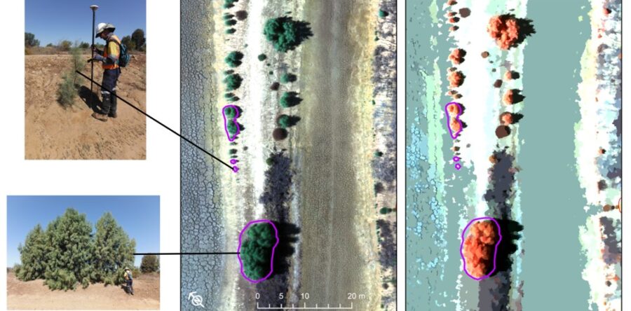
The Bralca team is excited to be attending the 22nd NSW Weeds conference this week ‘weeds gone wild’.[i] They will be showcasing some of the practical application of drones in weed treatment. That said, drones offer so much more when considering landscape scale weed management control. They are used to provide sound data about the…
Read more
Drone assisted landscape-scale weed management control