
The NSW Government announced today that it is ramping up efforts to tackle rising feral pig populations across the state, providing a $8 million boost to help fund a new coordinated control program.
Published 18th July 2023. Released by The Premier, Minister for Agriculture. https://www.nsw.gov.au/media-releases/13-million-to-tackle-feral-pig-problem
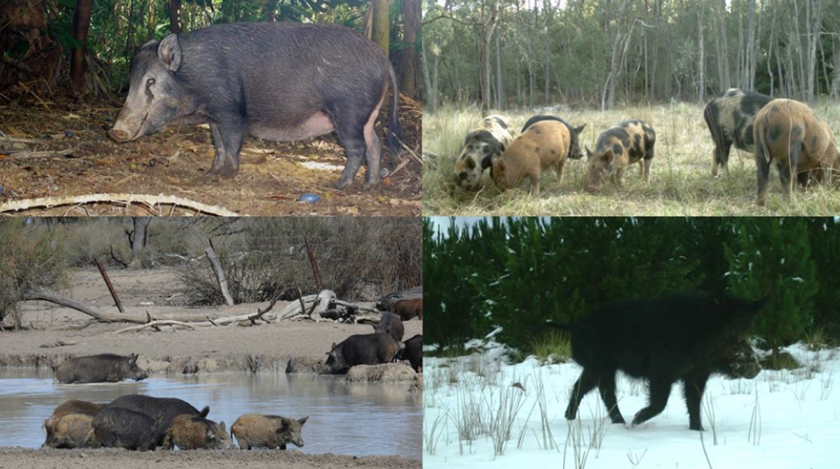
With pigs hosting a number of endemic parasites and diseases, their impact on Australian Agriculture can be profound, particularly when viewed through the Biosecurity lens. They can carry and transmit a range of both animal-related and zoonotic diseases, such as leptospirosis and Brucellosis (DPI NSW)
Part of the solution, particularly by providing sound data, can be addressed using drones. How can a drone help?
- Assisting to quantify and locate where there are mobs of pigs
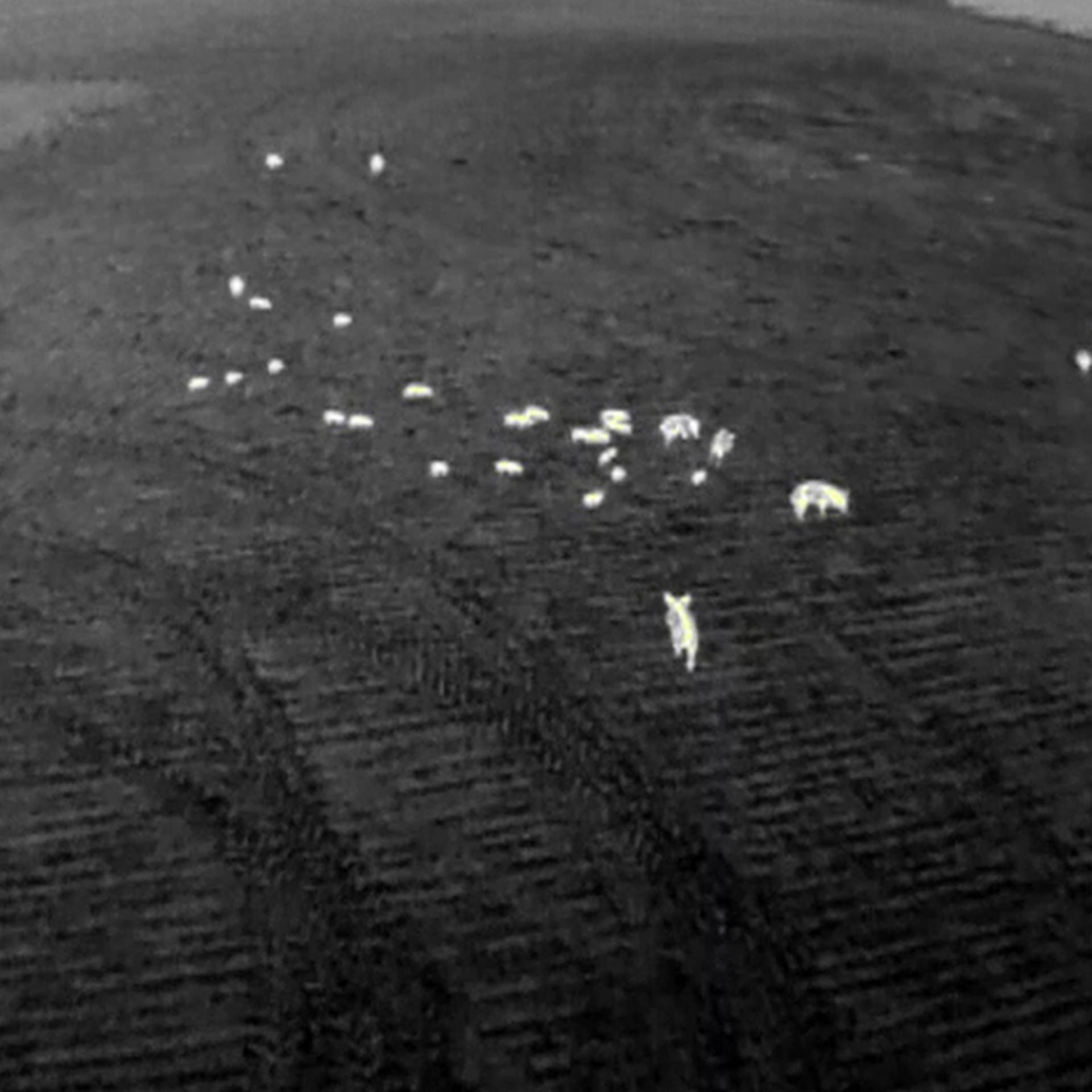
Identifying and locating a mob of pigs can be tricky. They tend to be very mobile with a boar covering between 10 to 50 km2 (Agriculture Victoria). Bralca owns and operates military spec long range drones which enable the capture of large scale thermal imagery alongside standard live feeds (optical surveys) to understand the landscape and locate pig populations. This can be done at a fraction of the cost of traditional aerial surveys.
- Collating before and after data to understand the effectiveness of control activities
It is recognised that any pig control program must achieve at least 70% removal to have an effect. Quantifying this to know which control activities are creating the desired impact can be achieved through the use of drones with specialist cameras attached to scan large areas of land and provide pig number calculations. The Griffin Pro blue edition, used exclusively by Bralca, has a 2.5hr flight time, 30km beyond visual line of sight range, (60km radius) vertical take off and landing capable, inaudible at 120m, is equipped with the latest technology in thermal sensors and optical cameras and can map over 1,000Ha with a single battery.
The data from the Griffon Pro provides a cost effective report with certainty of what 70% population reduction looks like and when it's achieved, it's hard data, provided in a green cost effective way. This in turn supports knowledge about what techniques work in the variety of landscapes across Australia.
- Keeping aerial surveys safer and more accessible to land managers
Traditionally, aerial assessments are made by air involve helicopters and gyrocopters. Low level agricultural helicopter operations are considered one of the nation's most dangerous professions, with CASA describing the sector in a report as "hazard rich" due to low-level flying and risks of terrain, trees and powerlines. Where a drone can supplement the work of a fixed wing or rotary wing aircraft, it becomes a key consideration.
These are both expensive and dangerous (drones operations come in at under ½ the cost of traditional methods). Using drones allows pilots to use their skills whilst staying safely on the ground.
- Caring for the Environment
Drones run on a small LiPo Battery, that's it, no petroleum fuels, no oils, no grease, no exhaust, nothing, just a battery. However, this is just the beginning when considering environmental factors with air flight. The Griffin pro blue edition used exclusively by Bralca, is inaudible at 120m, it can't be heard, the fauna can't hear it and neither can grazing stock, they just don't hear it. The Griffin pro can operate in sensitive environmental areas knowing noise pollution won't be an issue.
How can Bralca play a part?
Yes; Bralca has highly specialised military spec drones that can take accurate heat maps and images to assist with state run, coordinated efforts. Bralca has partnered with global developers and manufacturers to access subaudible surveillance drones providing live feeds to team commanders that meet CASA requirements to assist with pest animal control. Whilst this assists in both mapping and control operations, it is just part of the solution.
NSW covers 801,600 square kilometres so we believe the greatest impact is supporting the land managers across that expanse to build their own skills and knowledge around the use of drones in their enterprise. The fully accredited Drone training under Agskilled 2.0[1] gives land managers the skills to monitor their own lands and connect into coordinated programs with more accurate and timely data than centralised entities trying to achieve this alone. We believe this puts the knowledge and power into the wide variety of land managers across our landscape and recognise they have an invested interest in getting this right. By working together and coordinating local, regional and state based activities, drones can play a major part in supporting Australia’s biosecurity efforts[2].
Bralca.com: creating choice through knowledge
By Ben Watts and Mark Sykes
[1] Drones in Agriculture and Farm mapping and data collection are both available through Tocal College. Pastoralists are now eligible in the next round commencing soon.
[2] Kangaroo Island early efforts to use technology to eliminate feral pigs
